
Minaret Lake Loop
Backpacking // 26 Miles // 2 nights // Last updated: September 2023
There’s no shortage of hiking guides for the Eastern Sierras. But in planning our trip to Minaret Lake, the guides we found were not as detailed or complete as we’d have liked. So here’s everything we know, in one place!
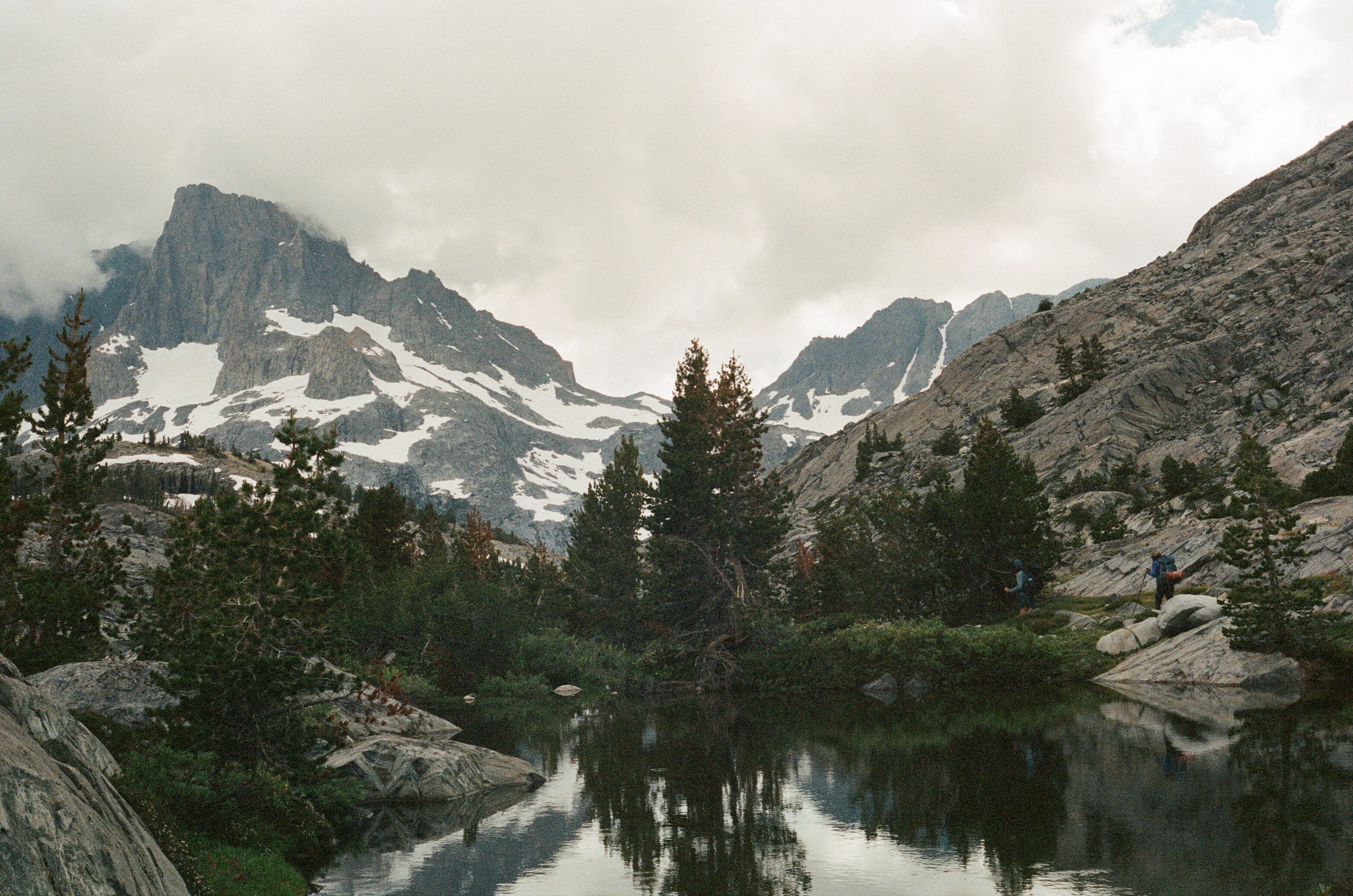
Driving along Postpile Rd, the Minarets, a series of craggy peaks in the Eastern Sierra stand looming across the valley. I remember them from my PCT hike, a range that stood far deeper into the mountains than the trail hugged a valley wall. The friend who invited us to go “to the Minarets” put it simply: “I saw the peaks and I thought, ‘What are those!?’” Both inspiring and close to several trailheads, the Minarets are a perfect weekend backpacking destination.

Difficulty
Most of this loop is well-traveled and well-loved. There are a few notes below on variable trail conditions and potential problem spots that may challenge even a seasoned backpacker’s skills and comfort.
Grade: The sustained climbs and descents on this loop top out around 18%, but average between 8-11%. We gained 4,800 feet over 26 miles.
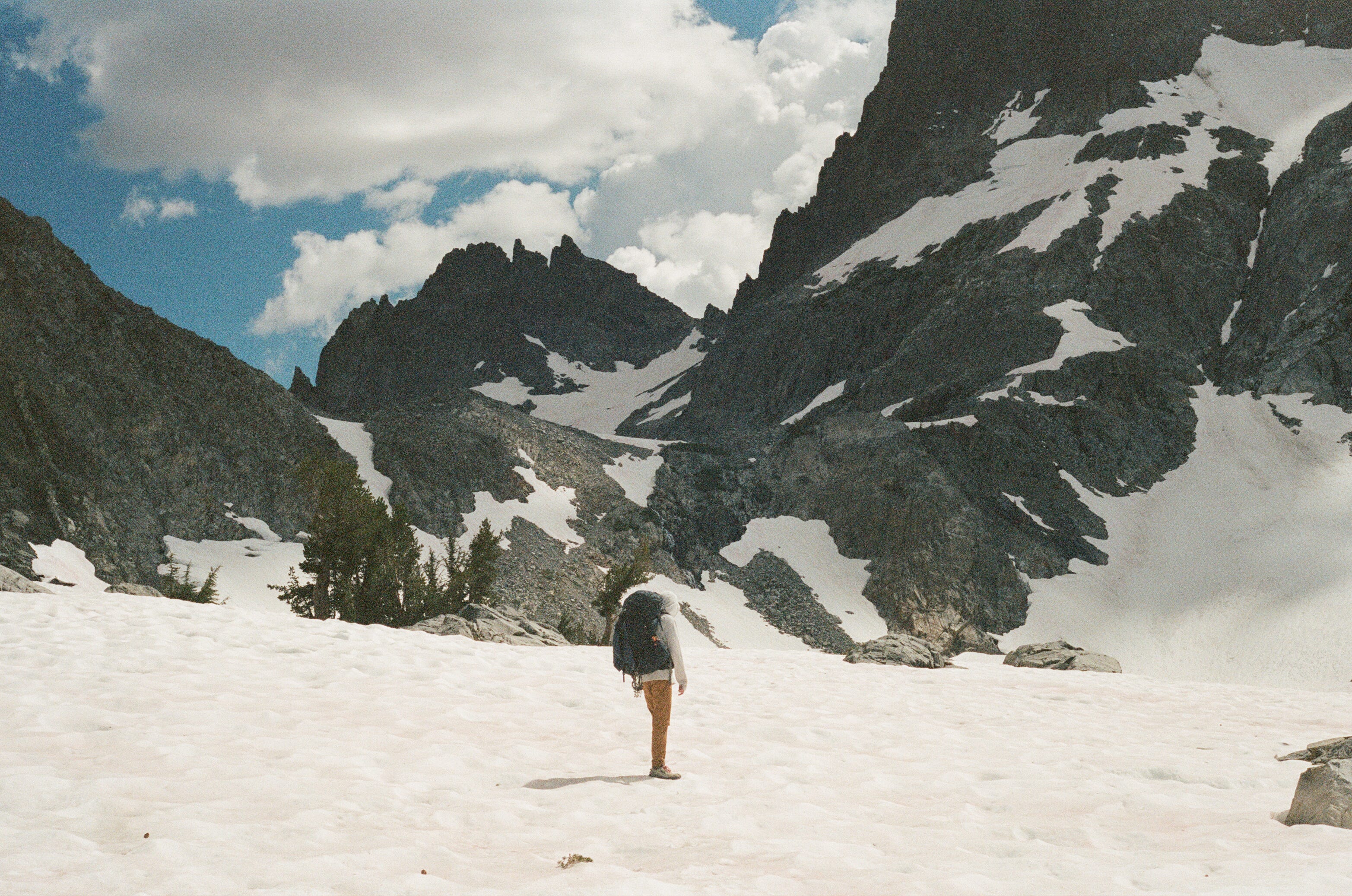
Terrain: The PCT portion of this loop is primarily packed dirt. The Minaret Creek trail has more loose rock. Between Iceberg Lake and Minaret Lake, the trail disappears and hikers must way-find over steep and loose scree (more detail in the itinerary.)
Trail condition: Trail conditions will vary yearly and monthly, depending on the winter snowpack and storms. In mid-August 2023 (a record snow year) we encountered snow patches primarily alongside lakes. The only major stream crossing (Shadow Creek on the JMT on day two) was knee-high when we crossed in the late morning, but hikers a couple of weeks earlier reported waist-deep water. We prepared to potentially bail out if trail conditions surpassed our comfort, and use the JMT or PCT to return to the trailhead.
Navigation
Day One (~9.5 mi, including a spur to the campsite): We departed from Agnew Meadows and took the High Trail/PCT to Thousand Island Lake.
Day Two (~10.5 mi): From Thousand Island Lake, we headed back Southbound on the JMT to the Shadow Creek Trail up to Cecile Lake*, which becomes the Minaret Creek trail, which we took to camp at Minaret Lake.
Day Three (7.5 mi, including Devil’s Postpile): From Minaret Lake, we followed the Minaret Creek Trail back to the JMT and then exited via Devil's Postpile where the JMT and PCT meet.
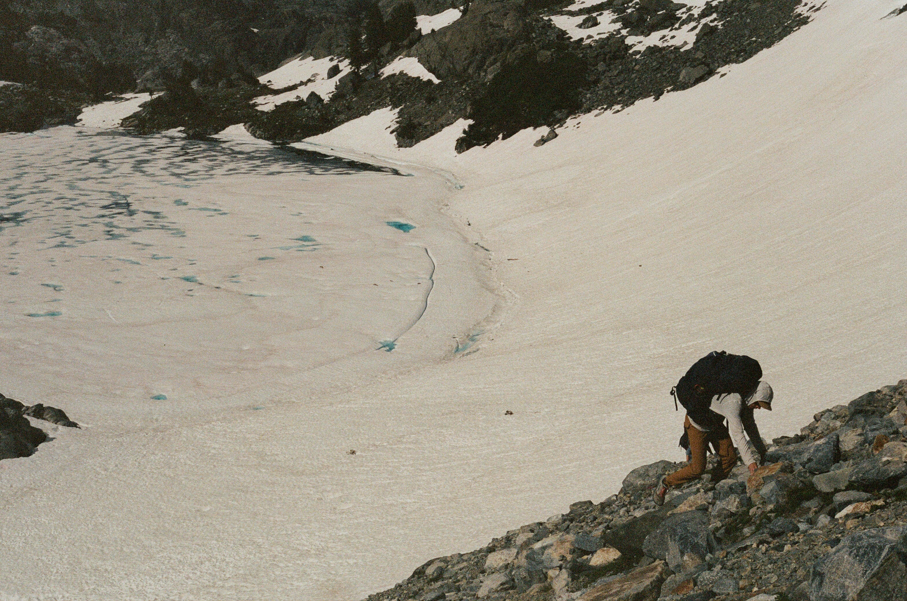
*Between Ediza Lake and Minaret Lake, the trail is difficult to follow or altogether does not exist. Expect wayfinding and Class 3 scrambling (exposed, hands necessary.) You can see from this Strava heatmap where the trail disappears even in snow-free conditions:
Below is our view of the trail from Iceberg Lake. We crossed the snow with microspikes, keeping well above the lake. We then scrambled up the talus and scree slope, keeping left of the waterfall, per the guidance of a hiker who’d just come down the trail. I did not have comparable experience and was glad to be doing this loop counterclockwise so I was climbing up the loose stuff. The grade maxed out at 44% on this climb.
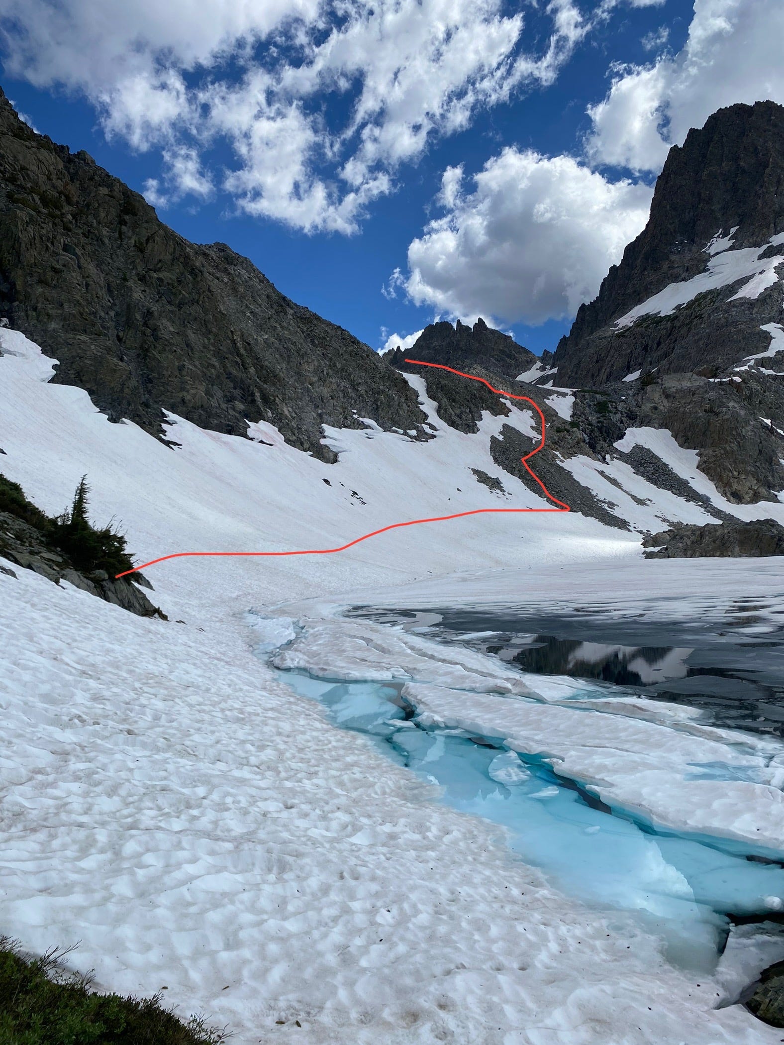
From the saddle, we reached Cecile Lake. We picked our way around the boulder field, and continued without a trail down the left canyon, again from advice from other hikers who’d come up. Maps show a different slot canyon (further around the lake) that we heard required some more technical climbing skills. The way down to Minaret Lake was still steep, but not nearly as loose.
Weather: It rained on us every day. Always be prepared for changing conditions, and jump in lakes when you know you have time to dry off. Ediza Lake was the right one for us to take a (very cold) dip.
Logistics
Maps: We downloaded these two AllTrails maps, to track our location on the snow relative to the trail from Ediza to Minaret Lake. Our friends used the Hiking Project. Additionally, trail junctions are well-marked.
Our Strava routes: Here is the route on Strava You can see where we went off-trail below. It was always clear at least what direction to move in.


Permits: You’ll need a permit from Inyo National Forest. Registration opens 6 months in advance, and the permits are popular. Plan to set alarms and book quickly.
For this route and itinerary, you’d need:
Entry Point: High Trail AA09 and
Exit Point: Minaret Lake AA11.
Camp Areas: Thousand Island Lake and Minaret Lake.
You will also need a California fire permit to operate a stove.
The Inyo National Forest spans multiple territories. We left from Nüümü lands. I paid rent to @Indigenouswomenhike, whose work in the area I admire.
Transportation to the trailhead: Unless you have booked a campsite at one of the trailheads (such as Agnew Meadows) you will need to book a shuttle from Mammoth Mountain, where you can leave a car. More info here.
Cell Service: There is a little bit of spotty service on the High Trail. We brought a Garmin Inreach in case of emergency.
Water: There are abundant water sources on this route. Make sure you have enough between Ediza and Minaret Lakes if it’s snowy. That section took us several hours.
Campsite Options: There is dispersed camping along this trail, but it seems most users prefer to camp near lakes. While we were there, signs indicated popular areas & sites that were closed for restoration. And please: don’t set up your tent on a site and eat in another one, or store your bear can on an impacted site! Find a great rock to enjoy dinner on. There was a lot of unnecessary spreading out along Thousand Island Lake that made it hard to find a good (open) site.
Gear Notes: I’ll simplify the rules for you: You need a bear can. There are no good trees for a proper bear hang. And it’s a popular area, which means animals are more habituated to people. We heard fellow campers shooing away something on night one. 2023 was a high snow year, so we brought microspikes. Not technically necessary in the soft snow, but still helpful. Pack the ten essentials, and use what you have!
Before you go, review the 7 Leave No Trace Principles
Happy trails!
Allie & Jeremy
Looking for more?
What is there to do but keep hiking?

I got used to crying in front of strangers while thru-hiking. Somehow, in the vast mountain spaces, there’s always someone bounding along the trail when you’ve hit rock bottom, or are just absolutely exhausted. And when you’re dehydrated, there’s only ugly, puffy-for-hours-if-not-days crying. At least, that’s what it felt like for me, and it happened a …
Pacific Crest Trail Journal

June 22, Mile 836.5 My alarm goes off for a late start at 6AM. My head still feels heavy and my body aches despite the extra sleep. The elastic in my hoodie presses into my eyes. I roll over on t…